- Ski.com Home
- Blog
- Feet Of Snow Forecasted For Utah, Wyoming, and Colorado By Friday
Feet Of Snow Forecasted For Utah, Wyoming, and Colorado By Friday

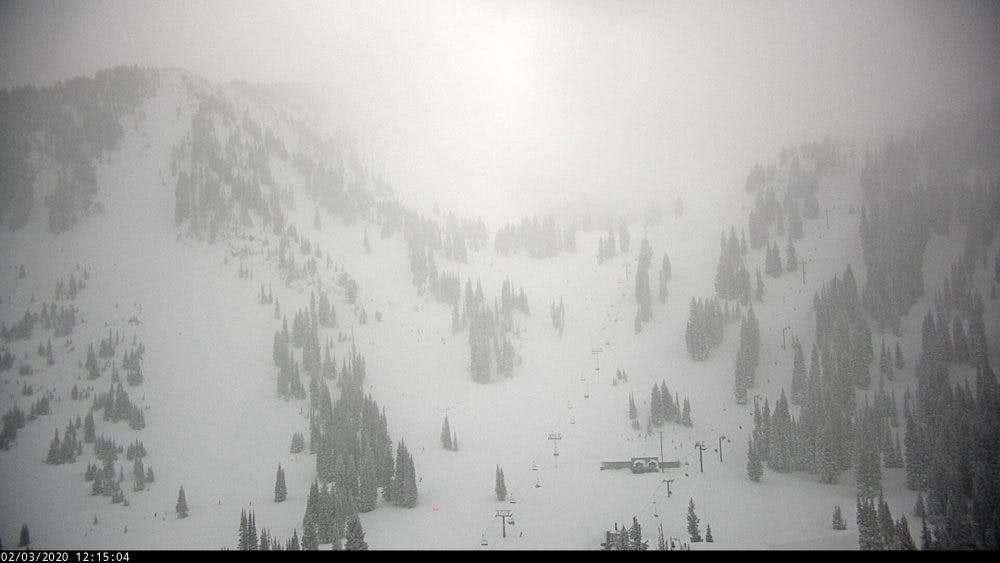 Alta Ski Area currently in the midst of the storm | Cover: NOAA
After a dry spell over the weekend, an active weather pattern is moving back into the great basin of the Western United States and with that change comes cold temps and abundant snowfall.
How much snow you ask? How about over a foot of blower powder for portions of Utah, Colorado, and Wyoming!
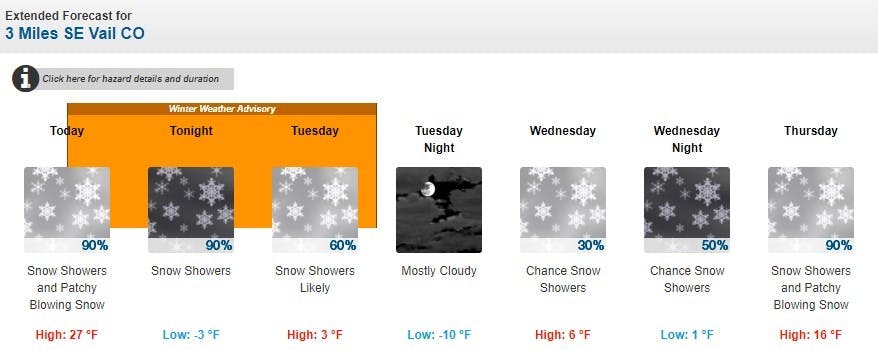
As of Monday morning, Winter Storm Warnings and Winter Weather Advisories are currently in effect for the Wasatch, central/northern mountains of Colorado, as well as the Tetons. Of those three states, expect all three to see similar accumulation totals that should range in the 5-12" range by Tuesday evening. From Wednesday on, expect even more snow to affect these 3 regions with up to another foot of snow by the weekend.
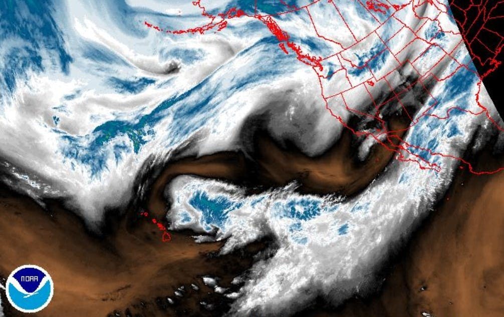
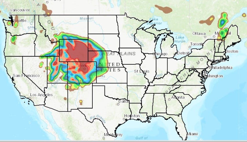 The forecast radar for 2/4/20 | Image: NOAA
LET IT SNOW!
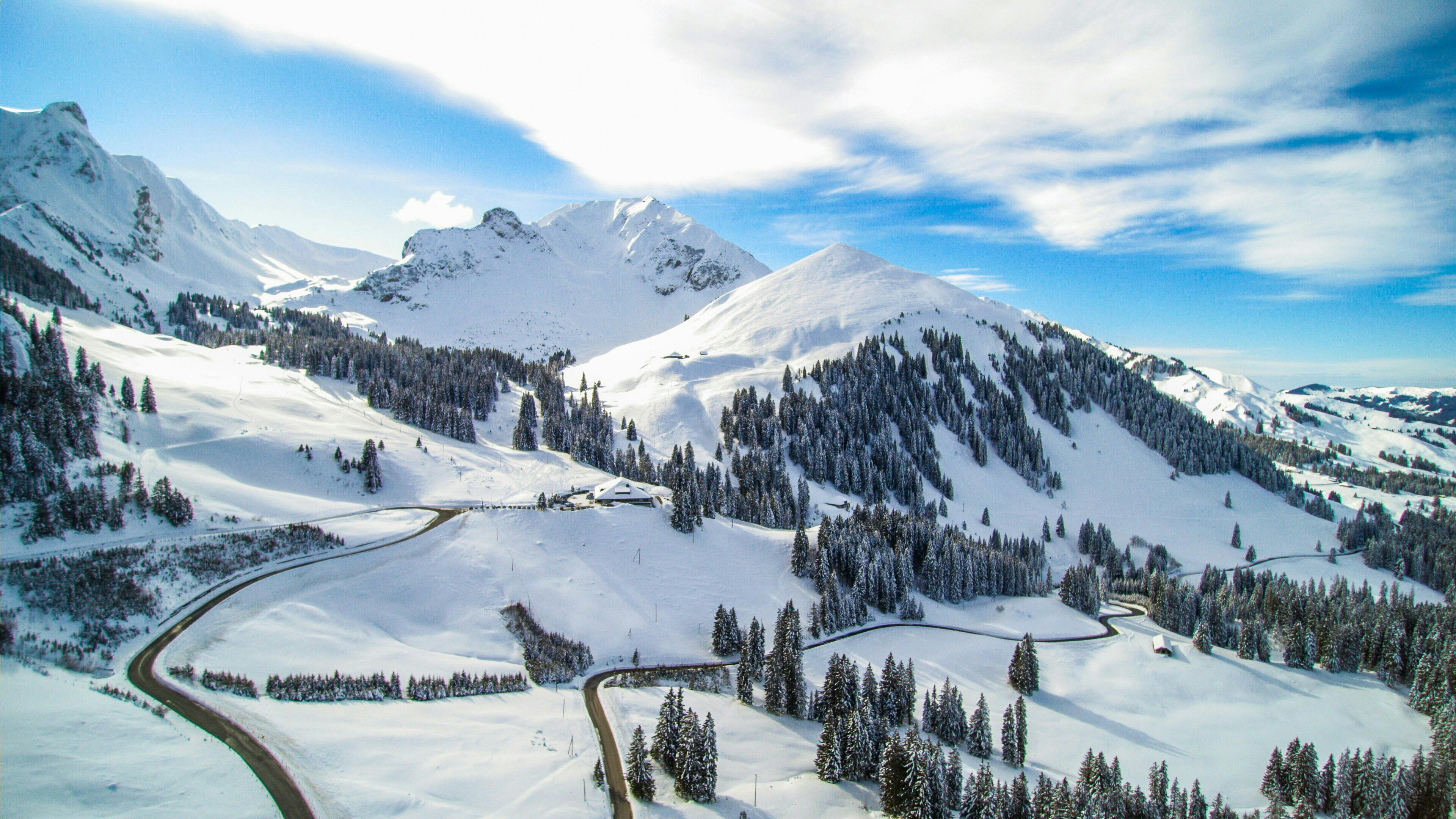
Vail, CO:
Park City, UT:
Jackson Hole, WY:
Winter Weather Advisory [COLORADO]
...WINTER WEATHER ADVISORY REMAINS IN EFFECT FROM NOON TODAY TO 6 PM MST TUESDAY...
* WHAT...Snow expected. Total snow accumulations of 6 to 10 inches with locally higher amounts. Winds gusting as high as 50 mph above timberline today.
* WHERE...Elkhead and Park Mountains, Upper Yampa River Basin, Gore and Elk Mountains/Central Mountain Valleys and West Elk and Sawatch Mountains.
* WHEN...From noon today to 6 PM MST Tuesday.
* IMPACTS...Travel will be very difficult at times with patchy blowing snow significantly reducing visibility, especially in open areas. Expect all mountain passes to be affected with occasional whiteout conditions possible due to the combination of gusty winds and snowfall.
https://twitter.com/NWSGJT/status/1224300801025142784
Winter Storm Warning [Utah]
...WINTER STORM WARNING REMAINS IN EFFECT UNTIL 10 PM MST THIS EVENING...
* WHAT...Heavy snow. Additional snow accumulations of 1 to 4 inches.
* WHERE...In Wyoming, Southwest Wyoming. In Utah, Wasatch Mountain Valleys.
* WHEN...Until 10 PM MST this evening.
* IMPACTS...Travel could be very difficult, with impacts to the Monday morning and evening commutes. Blowing snow will cause poor visibility.
https://twitter.com/NWSSaltLakeCity/status/1224407050412679168
Winter Storm Weather Advisory [Tetons]
...WINTER WEATHER ADVISORY REMAINS IN EFFECT UNTIL 11 PM MST THIS EVENING...
* WHAT...Moderate to Heavy Snow.
* WHERE...Yellowstone National Park, Teton and Gros Ventre Mountains and Jackson Hole.
* WHEN...Through 11 PM MST Monday. The worst conditions are expected this morning.
* SNOW AMOUNTS...Snowfall of 3 to 6 inches in the Jackson Valley. Snowfall of 7 to 14 inches in the mountains. Snowfall in Yellowstone National Park will range from 6 to 12 inches.
* IMPACTS...Travel may be very difficult tonight and Monday.
* ADDITIONAL DETAILS...Teton Pass and Togwotee Passes will be impacted. Winds of 15 to 25 mph with higher gusts will likely bring areas of blowing and drifting snow.
https://twitter.com/NWSRiverton/status/1224300709899726848
Get ready for fresh tracks. Ski.com’s Mountain Travel Experts are here to help you plan and book everything for the perfect ski vacation. Call 800-610-8911 or fill out a brief from to receive a quote in your inbox >>
It takes 2 minutes.
TAGGED: conditions, long-range forecast, North America, Snow Report, stoke-worthy snow, usa, weather, Western ski resorts
Barclay Idsal
Author
Latest blogs
View All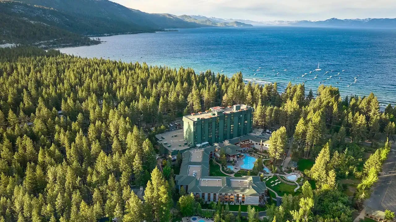


How Our Free White (Ski) Glove Service Works:

Reach out to a Ski.com Mountain Travel Expert by phone, chat, or our online form. Share details about your group size, interests, and budget and your Expert will begin to craft your dream ski vacation.
Get a curated proposal with personalized suggestions from your Expert via email. Book directly online or request additions or revisions from your Expert until it’s perfect.
If you have questions, want to add or modify your reservations or need anything assistance, your Expert is always by your side to help before, during and after your trip.
Sign up for our newsletter
Sign up for exclusive offers, news, updates and more.